


This web page is created within BALTICS project funded from the European Union’s Horizon2020 Research and Innovation Programme under grant agreement No.692257.
Flooded territories in remote sensing data
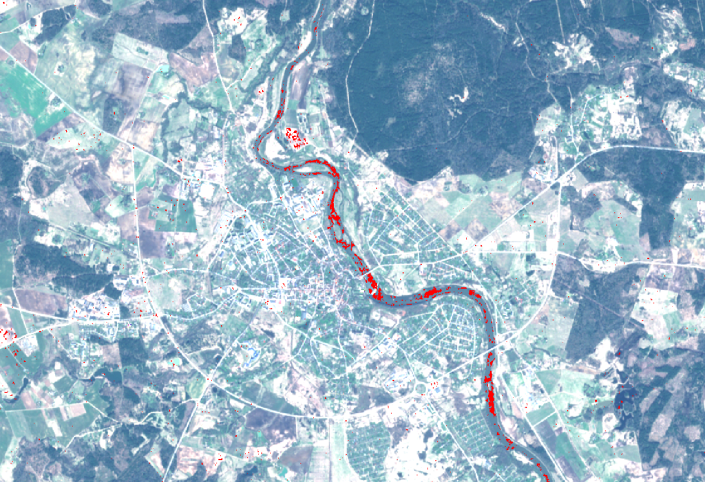
During the end of August 2017 media reported that east part of Latvia was flooded because of heavy rain. It caused serious damage on roads and farming land. Remote sensing department of VUC ERI VIRAC processed SAR (Synthetic Aperture Radar) satellite images to find out how efficiently is it possible to detect flooded areas using satellite data.
SAR satellite images are being captured using radar technology. It means that the instrument transmits microwave energy on the surface of Earth and creates an image from received signal reflection. The greatest advantage of radar image is that it doesn’t depend on weather and natural illumination conditions, when data have been acquisited.
Three Sentinel-1 satellite images were used to detect flooded territories. One of them was taken on August 2nd – before flood, but the other two images were captured on September 1st when the water level was high. A binary mask was created from these images that shows the flooded areas.
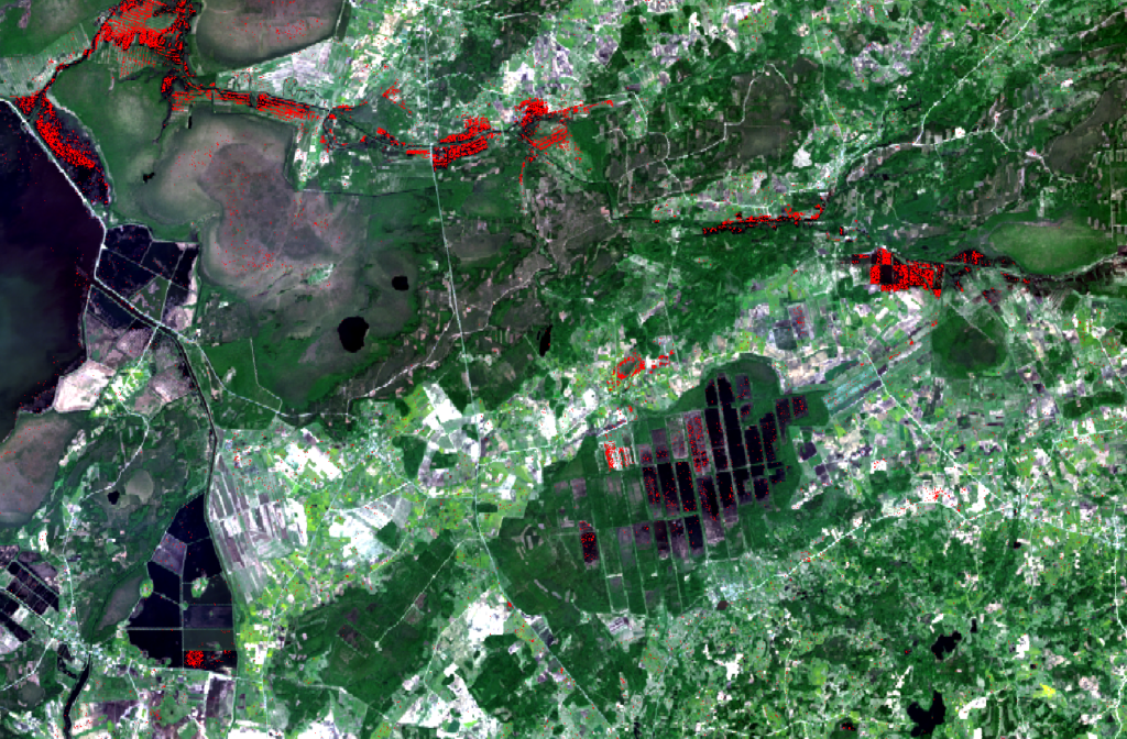
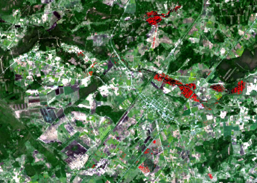
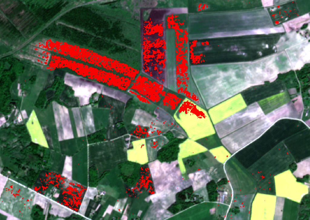
Few weeks after flood in eastern Latvia, another rise of water level started in Kurzeme, western Latvia because of cyclone that crossed Europe. The radar image that represents situation before flood was taken on September 9th but images during water level rise were captured on September 21st and 22nd.
Further research will be focused on data validation.